Students learn hands-on skills, have lots of fun in Montana Tech’s Field Geology course
7-22-2023
All photos courtesy of Celine Beaucamp
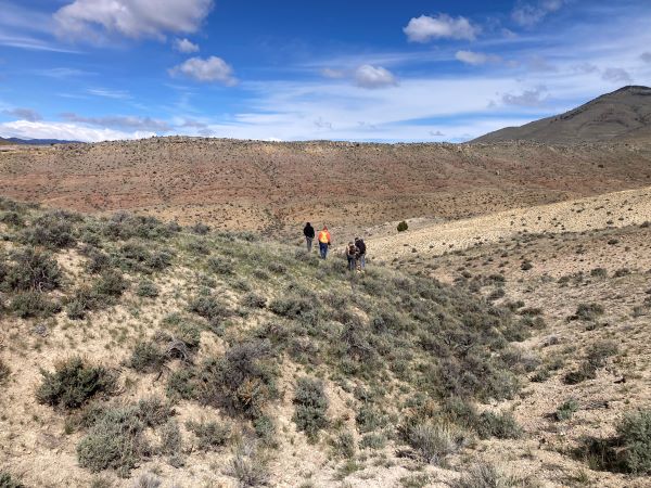
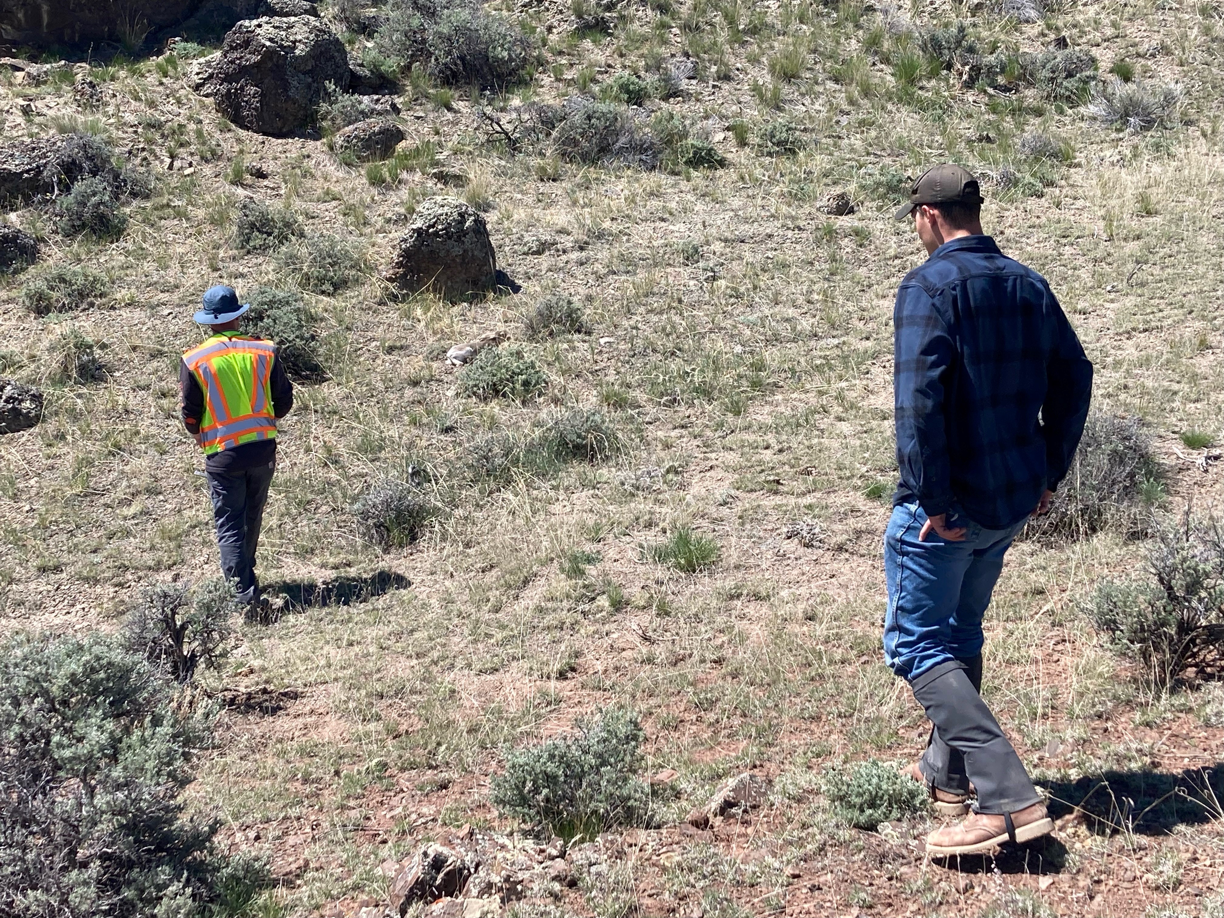
Several students at Montana Technological University spent much of the month of May completing hands-on learning via fieldwork in the picturesque mountains of Southwestern Montana, mapping and collecting data for a Field Geology course.
Field camps usually take place before or after senior year for geological engineering students. They help students gain practical experience in measuring and creating maps or reports, all of which are required by employers.
The first 2-week course was taught by Celine Beaucamp, an Earth Sciences and Engineering Ph.D. student at the Lance College of Mines and Engineering.
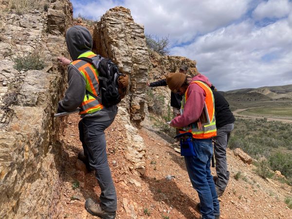
“Participating in Celine Beaucamp's Structural Geology Field Camp was an enriching experience,” said Jasmine Singh, a geological engineering senior from Antioch, California. “The students were assigned to teams and had to create our own geologic map of the areas we visited. It was both challenging and exciting. It required the students to identify rocks, faults, and secondary structures in the field.”
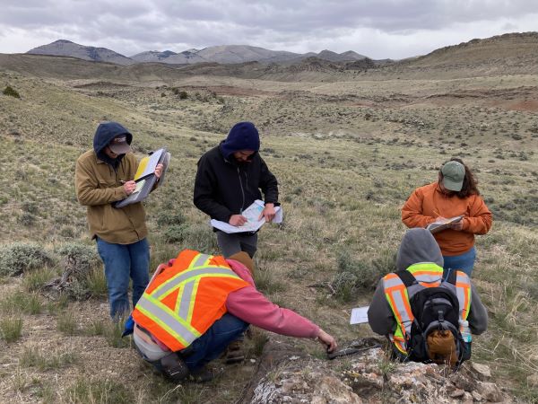
Beaucamp took the students to several geological sites, including the Sandy Hollow anticline field, a former chromite mine, and various sites in Butte where the geology shines through the urban landscape.
“Professor Beaucamp's teaching style encouraged us to delve deeper into understanding depositional environments and the geological processes that shaped the areas we were mapping,” Singh said. “This not only improved our mapping skills but also boosted confidence in rock and structure identification. The weather posed a significant challenge, especially on rainy days, which could be quite taxing. Overall, the course was incredibly rewarding, leaving me feeling more competent and self-assured in my geological mapping abilities.”
Beaucamp tells students to use their power of deduction if they are left looking at a rock formation and unable to identify it. She reminds students to remember the three types of rocks and begin eliminating what types of rock the formation cannot be. Students have to hike the area they are mapping, and they rely on each other to figure things out.
“The field course fosters teamwork and reinforces fundamental geological concepts acquired over the past four years,” Singh said. “We translated field data into analytical reports, enhancing our understanding of the areas. This preparation is crucial for future endeavors in geological mapping, essential for fields such as exploration, mining, and engineering.”
The Sandy Hollow anticline is a famous formation that academics from around the U.S. travel to study, Beaucamp notes.
“Even though it has been mapped many times before, they discovered something new this year,” Beaucamp said.
Students document their work using paper, pencil, and electronic applications. They compile professional-style reports that include not only maps, but also cross sections, which can be extra challenging to create, depending on the structure of the rock formation being studied.
Beaucamp says the experience is not meant to be overwhelming, but instead is a learning experience.
“Knowledge and skills are, of course, fundamental, but equally critical is that students and instructors have fun! I want the students to break the 'staring contest' with the outcrop that many young geologists have,” Beaucamp said. “Building confidence in the students' knowledge closes the loop of everybody's four years of hard work. Plus, I want students to be proud of themselves. It’s my favorite class to teach.”
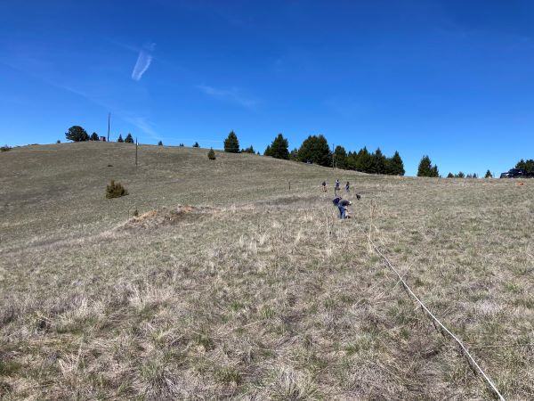
Students also completed a 2-week session with Geological Engineering Department Head Dr. Glenn Shaw.
Shaw took students to an area where restoration workers had installed beaver mimicry structures in an attempt to hold more water in rivers in August and September when flows were low. To understand the mechanics of the natural forces at work at the site Shaw needs to know where clays are, where sands are, and how deep they are. Students hand-augered samples of sediments, and drilled a small well to gain more data on water flow at the site.
“This camp was special because I hired a graduate student in geophysics to help me so they could apply seismic and electrical resistivity in geophysics principles,” Shaw said.
Students used their skillset to do everything Shaw needed, but they also went above and beyond what was asked.
“They did all this extra stuff,” Shaw said. “They were a great class because they were so hardworking. They would also just do tons of work and ask for more work to do. They wanted to meet at 8 a.m. They wanted to stay late. They wanted to go into the computer lab to process the data.”
Students encountered a late spring snow that blanketed the landscape, and though Shaw offered to have an indoor lab day to process data and work on reports, the students choose to work in the field instead. In addition to getting a lot of work done, students also enjoyed frolicking in the woods a bit.
“They would just play like little kids,” Shaw said. “They just wanted to go and have fun. It’s a balance of teaching, using it for something useful, making sure they understand what’s going on, giving them freedom to chase the areas they are interested in, but giving them a little bit of time to have fun, too. Field Camp is a good time.”
Montana Technological University accepts applications for admission on a rolling basis. To learn more about Geological Engineering and submit an application, click here.